I’m always on the lookout for new locations to represent artistically on maps in my own unique way. Up until now, I’ve concentrated on areas very familiar to me in the North-East of England and the Lake District but, in order to avoid repeating paintings of the same locations, this time I wanted to look further afield.
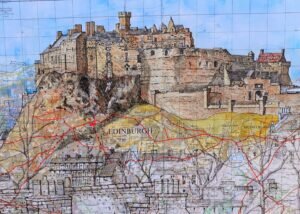
The city of Edinburgh has always appealed to me visually, with its dramatic buildings and topography and, having recently acquired a 1965 One Inch Ordnance Survey map of the city, it struck me how this would really lend itself perfectly to one of my special panorama pieces. The skyline of Edinburgh with its Castle on the hill and the surrounding buildings is really beautiful. I’ve only visited on a couple of occasions but, while many people might be attracted to the retail area of Princes Street, my own interest is in the varied architecture of the Old Town, rising towards its fabulous castle perched on top of the extinct volcano of Castle Rock.
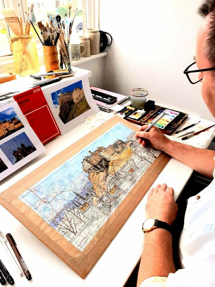
This just had to be the centre piece of my painting so I started to research the area, looking at maps and photographs, trying to establish the best vantage point for my piece. I finally settled on a very dramatic view looking up towards the Castle, as seen from National Museum of Scotland. I’m always keen that my paintings are considered in context so, apart from the painting actually being superimposed over a map of Edinburgh, I wanted to incorporate some of the landmark buildings surrounding the Castle such as the familiar spires of St Mary’s Episcopal Cathedral, while some of the buildings in the foreground give the castle a sense of scale. Having decided on this particular view, I worked from a series of photographs to create a panorama rising up towards the castle.
As regards the process of producing the painting, much of my work has already been done in the initial research and planning stages. This applies to all of my work of this nature, especially when I’m commissioned to produce a series of miniature paintings on one or more map extracts, so that I can achieve an effective balance between the specific places in the map and a the composition of the painting itself.
Looking at the map of Edinburgh itself, I decide on the extent of the map extract and, after checking and double checking, I cut this out to the correct size.
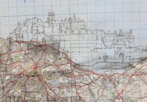
Possibly the most difficult stage comes next. I need to transfer onto the map the general outline of my drawing, which will eventually become a painting. This means producing an outline drawing and then tracing this onto the map, in the hope that the traced pencil lines can still be made out. Being a city, the map is quite densely printed in some areas, meaning that it can be difficult to distinguish my pencil lines from the printed lines and shaded areas on the map. This requires very good natural light and, although I do sometimes use daylight lamps, I usually reserve this process for the daytime!
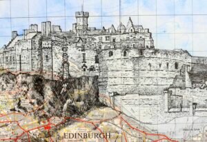
Having established a basic outline for the drawing in pencil, I move onto possibly my favourite stage, completing the drawing in pen, establishing as much detail as I dare but leaving most of the tonal work to the painting stage. I have to use a bit of self-control here because, as with a lot of artwork, it’s very easy to keep adding more and more detail, sometimes at the expense of the final effect. My University degree some 40 years ago was in architecture, so you can see that I could easily get carried away with this process.